
In cartographic history, the Waldseemüller Map stands as a landmark achievement that revolutionized the way Europeans viewed the world. Created in the early 16th century by the German cartographer Martin Waldseemüller, this extraordinary map not only depicted the known world of the time but also introduced Europeans to the concept of a “New World”—the continents of North and South America. With its innovative design, groundbreaking content, and far-reaching impact, the Waldseemüller Map remains one of the most significant maps in the history of cartography.
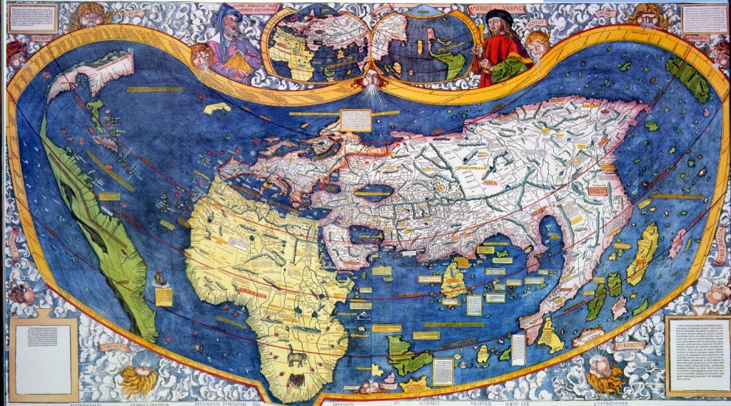
The Waldseemüller Map was created in 1507 as part of a larger work known as the Universalis Cosmographia, or Universal Cosmography. Commissioned by the German printer and publisher Johann Schott, the map was intended to be a comprehensive geographical atlas that would showcase the latest discoveries and advancements in cartography.
One of the most striking features of the Waldseemüller Map is its depiction of the Americas. Based on the accounts of European explorers such as Christopher Columbus and Amerigo Vespucci, Waldseemüller boldly labeled the newly discovered continents as “America” in honor of Vespucci—a name that would eventually become the standard designation for the New World.
The Waldseemüller Map had a profound impact on European perceptions of geography, exploration, and the world at large. For the first time, Europeans were presented with a visual representation of the Americas as distinct landmasses separate from Asia—a concept that challenged traditional notions of the world as a single, interconnected landmass.
The inclusion of the Americas on the Waldseemüller Map sparked a wave of excitement and curiosity across Europe, fueling interest in exploration and discovery. As news of the New World spread, European powers scrambled to stake their claims and explore the newly discovered lands, leading to the Age of Exploration and the eventual colonization of the Americas.
The Waldseemüller Map remains a testament to the spirit of exploration and discovery that characterized the Renaissance era. It represents a turning point in European cartography, marking the beginning of a new chapter in the history of geographical knowledge and exploration.
Beyond its historical significance, the Waldseemüller Map also holds cultural and symbolic value as a representation of the interconnectedness of cultures and civilizations. It serves as a reminder of the enduring human quest to explore and understand the world around us, as well as the importance of cross-cultural exchange and collaboration in shaping our collective knowledge and understanding.
The Waldseemüller Map stands as a milestone in the history of cartography—a groundbreaking achievement that transformed European perceptions of the world and paved the way for the Age of Exploration. By boldly depicting the newly discovered continents of North and South America, Martin Waldseemüller introduced Europeans to a world beyond their wildest imagination, sparking a wave of exploration, discovery, and cultural exchange that would forever change the course of history. As we reflect on the legacy of the Waldseemüller Map, we are reminded of the power of cartography to shape our understanding of the world and inspire future generations to explore, discover, and chart new territories in the ongoing quest for knowledge and discovery.
#WaldseemüllerMap #EarlyModernCartography #NewWorld #History #Exploration
