
The Genoese World Map, created in the early 15th century, offers valuable insights into European perceptions of global geography during the Renaissance. Commissioned by the Republic of Genoa, this magnificent map reflects the burgeoning spirit of exploration and discovery that characterized the Age of Discovery.
One of the most remarkable features of the Genoese World Map is its depiction of the known world at the time. Spanning from Europe to Asia and Africa, it reflects the expanding geographical knowledge of Renaissance Europe and the growing awareness of distant lands and cultures.
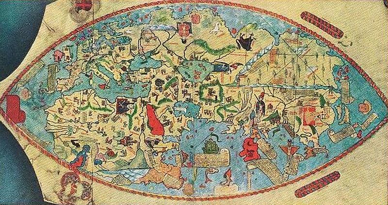
Moreover, the Genoese World Map incorporates elements of classical cartography, including Ptolemaic geography and medieval traditions, while also incorporating new discoveries and insights from recent explorations. This blend of old and new reflects the dynamic nature of Renaissance cartography and the evolving understanding of the world.
In addition to its geographical accuracy, the Genoese World Map is also notable for its artistic beauty and craftsmanship. It features intricate illustrations, elaborate cartouches, and decorative elements that highlight the map’s importance as both a practical navigational tool and a work of art.
As we study the Genoese World Map today, we gain a deeper understanding of the intellectual and cultural currents of the Renaissance period. It serves as a reminder of the transformative impact of exploration and discovery on European society and the enduring legacy of Renaissance cartography.
#GenoeseWorldMap #RenaissanceCartography #AgeofDiscovery #GlobalGeography
