
The Da Ming Hun Yi Tu, or the Amalgamated Map of the Great Ming Empire, is a masterpiece of cartography from the early 15th century Ming Dynasty in China. Commissioned by Emperor Zhu Di, this monumental map offers a comprehensive depiction of the known world at the time, combining geographical accuracy with artistic flair.
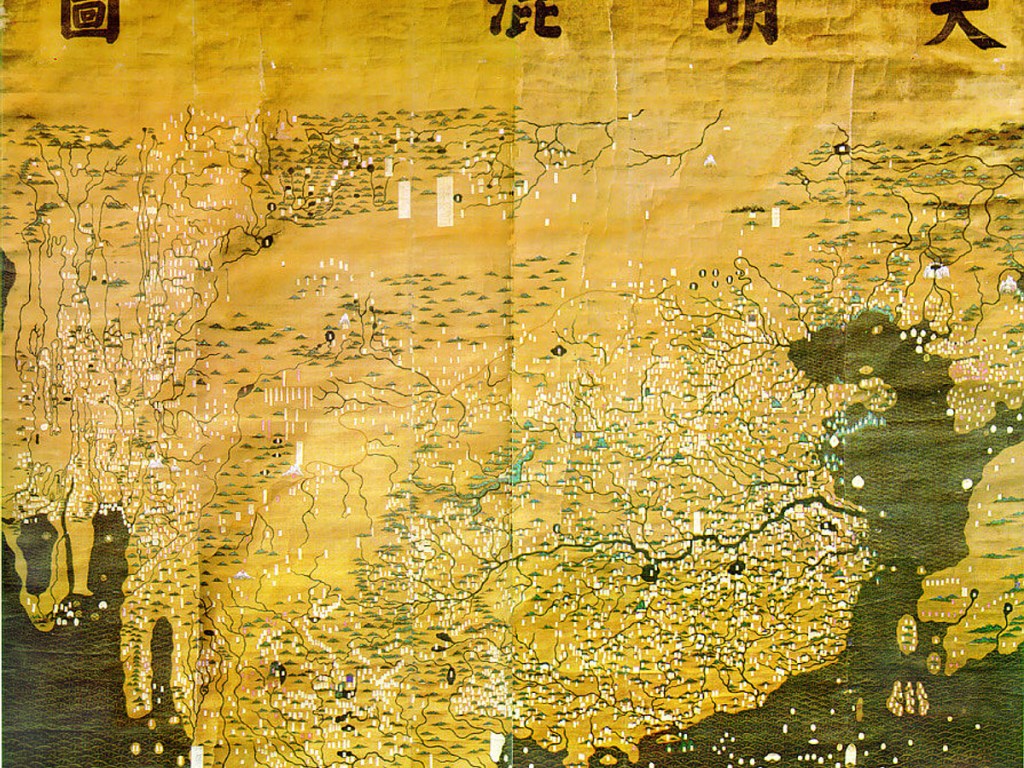
Measuring over 5 meters in length, the Da Ming Hun Yi Tu is one of the largest surviving maps from the Ming Dynasty. It covers not only the vast territories of China but also neighboring regions such as Central Asia, the Indian subcontinent, Southeast Asia, and Africa, reflecting the Ming Dynasty’s extensive diplomatic and trade relations with foreign powers.
One of the most remarkable aspects of the Da Ming Hun Yi Tu is its meticulous attention to detail. It includes geographical features such as mountains, rivers, and coastlines, as well as major cities, trade routes, and cultural landmarks, providing a wealth of information about the diverse peoples and landscapes of the world.
Moreover, the Da Ming Hun Yi Tu reflects the cosmological worldview of the Ming Dynasty, with China situated at the center of the map, surrounded by concentric circles representing the Five Elements and Eight Trigrams. This symbolism underscores the Ming Dynasty’s belief in the harmony and order of the universe, as well as its self-perception as the center of civilization.
As we study the Da Ming Hun Yi Tu today, we gain a deeper understanding of the Ming Dynasty’s worldview and its place in global history. It serves as a reminder of the interconnected nature of human societies and the enduring legacy of cartography in shaping our understanding of the world.
#MingDynasty #ChineseHistory #Cartography #WorldMap #DaMingHunYiTu
