
The Gough Map stands as a remarkable artifact of medieval cartography, offering valuable insights into the geographical knowledge and navigation practices of 14th-century England. Crafted on vellum around 1360, this map provides a unique perspective on the landscape, settlements, and travel routes of medieval England.
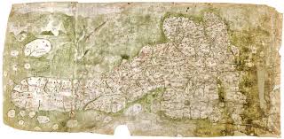
Named after its early owner, Richard Gough, the Gough Map is one of the oldest surviving maps of Britain. Measuring over one meter in length, it depicts the entire country from Scotland to the English Channel, with a level of detail that is unprecedented for its time.
One of the most striking features of the Gough Map is its focus on roads and travel routes. Unlike earlier maps that primarily depicted political boundaries or topographical features, the Gough Map emphasizes the network of roads and paths that crisscrossed medieval England, reflecting the importance of travel and communication in medieval society.
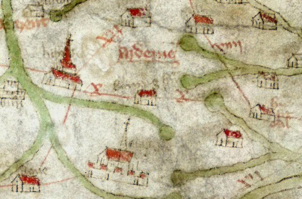
Moreover, the Gough Map offers valuable insights into the economic and social landscape of medieval England. It highlights major towns and cities, as well as landmarks such as castles, churches, and bridges, providing a glimpse into the infrastructure and settlements of the time.
As we study the Gough Map today, we gain a deeper appreciation for the challenges and complexities of navigation in medieval England. It serves as a reminder of the ingenuity and resourcefulness of our ancestors, who relied on maps like these to navigate the world around them.
#MedievalEngland #GoughMap #Cartography #HistoricalMaps #Navigation
